Summary: At the end of my season in 2015, I decided that I wanted to try a 70.3 in 2016. I’d heard about how great the Beach2Battleship 70.3 in Wilmington, North Carolina was… in large part because they give pajama pants to all finishers. I signed up in December, right after WTC bought the race and renamed it to IRONMAN 70.3 North Carolina, and then mostly forgot about it because my friend Ingrid was “encouraging” me to sign up for IM 70.3 New Orleans (which I did). I didn’t have a great race at New Orleans and wanted to do better this time. I did, by 46 minutes.
Sunday: new wheels, part 1
My friend Tony finished his season at AtomicMan by smashing the course, and he was kind enough to offer to loan me his race wheels, a Zipp 404/808 pair. I put them on the bike and took off for a ride the day before I was supposed to leave for California. PROTIP: when you change wheels, you have to adjust the derailleur limit screws. If you don’t do this, here’s what happens: you break the derailleur hanger, ruin your chain, put a big dent in your friend’s borrowed wheel, and break several spokes. On Sunday, when no bike shops are open. And while you’re 10 miles from home. A quick Uber ride home and I was left to sort out my plan: Dana would drop my bike off at the shop, they’d fix it, and I’d pick it up Thursday when I got back.

A broken derailleur is a terrible thing
Thursday: new wheels, part 2
Hosanna to the crew at Bicycle Cove. Chris, Parker, and Nick got the parts in and got the bike fixed. When I went to pick it up, though, I was surprised; instead of Tony’s Zipps, it was wearing a pair of Bontrager Aeolus 5s. They wanted Chris to look at Tony’s wheel again before clearing it for riding, you see, so they loaned me a set of their shop wheels to make sure I wouldn’t miss the race. “We’ll settle up later,” they said. “Now go have a great race.” Because we were having thunderstorms at the time, I didn’t get a chance to ride the new wheels; I had to load up and go.
Friday: flying and being pathetic
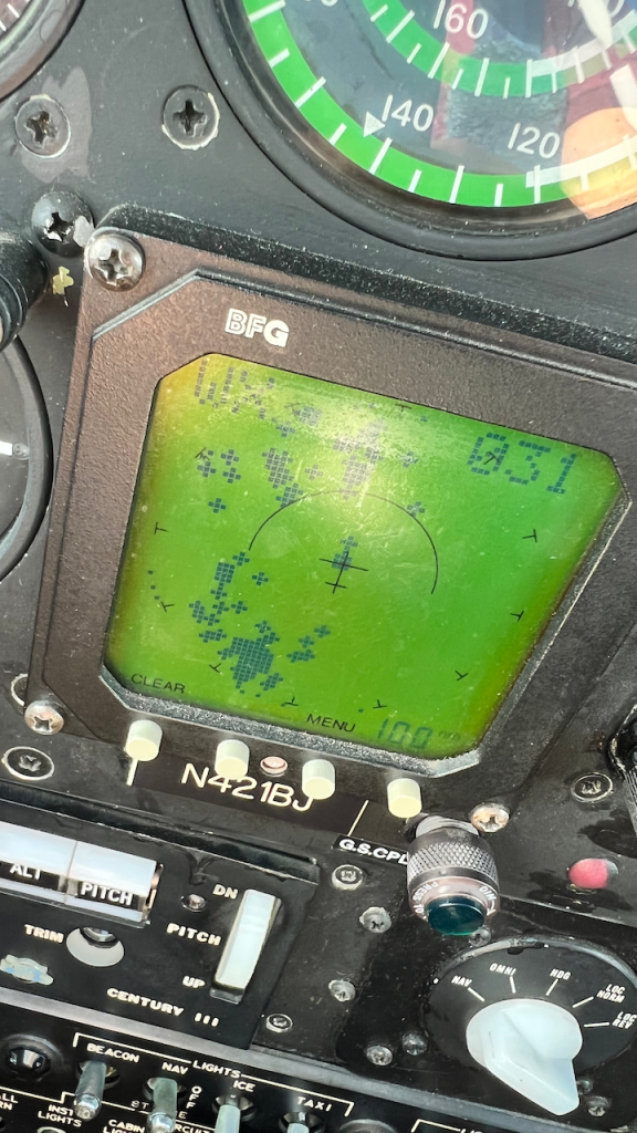
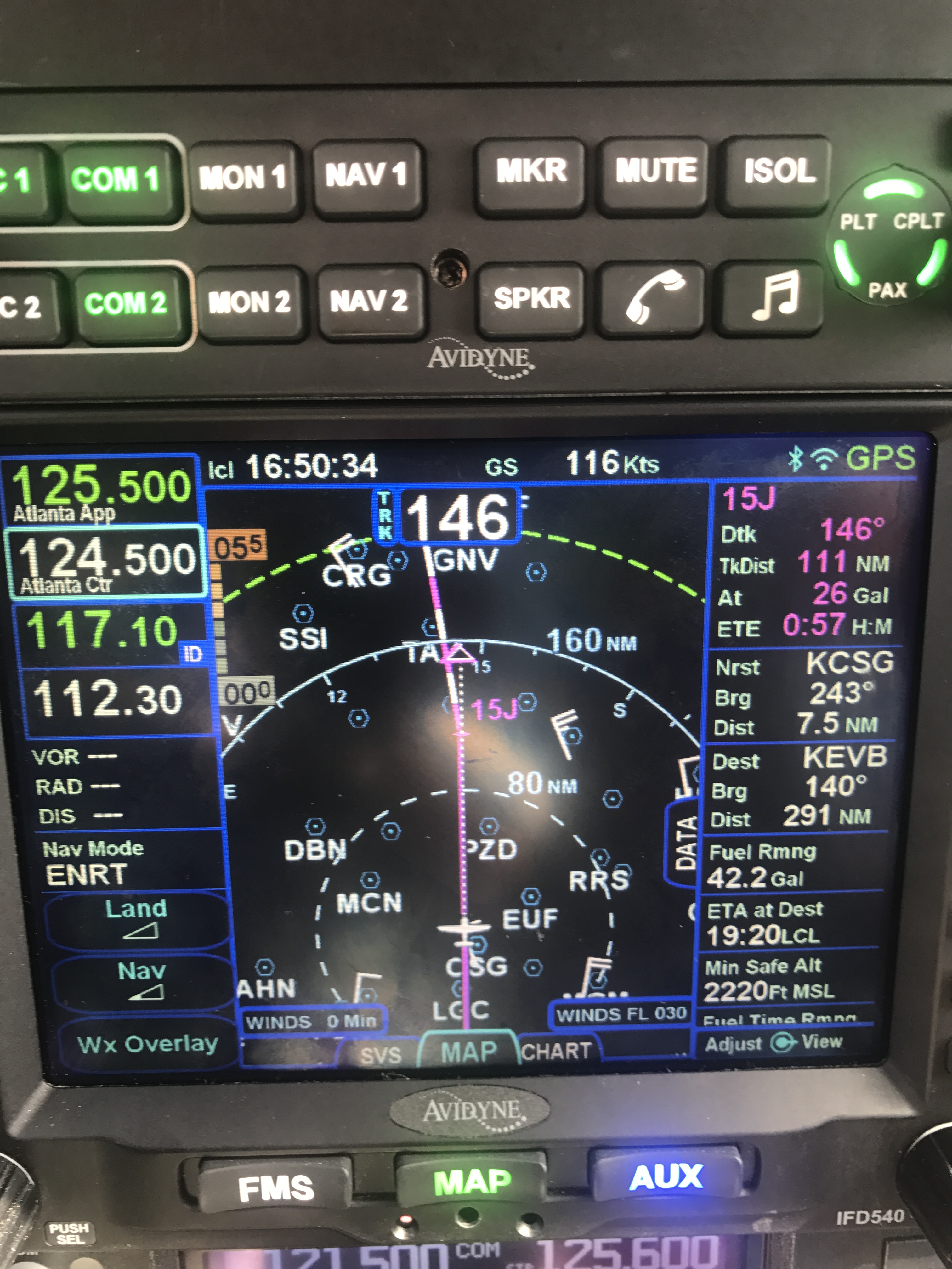
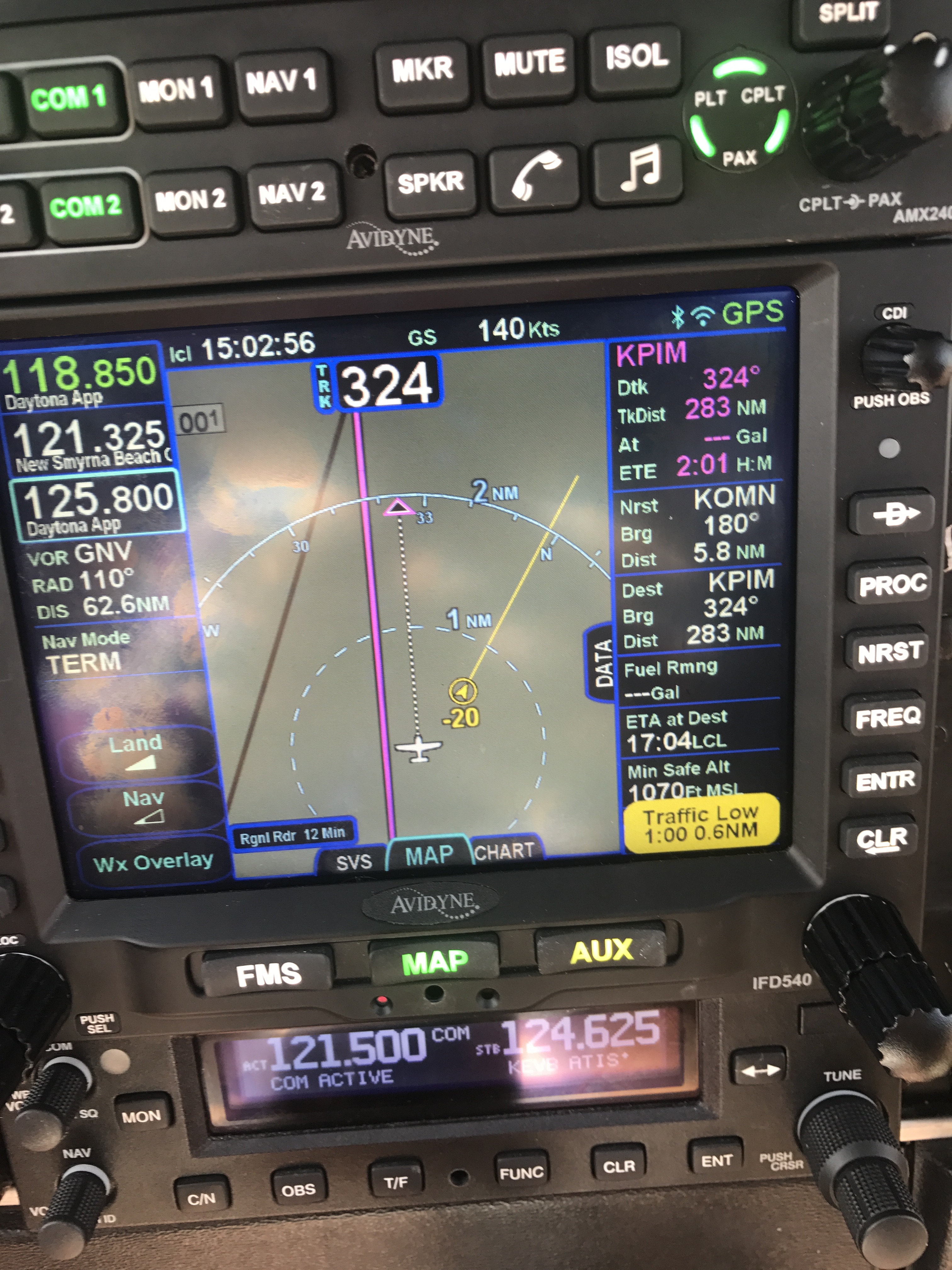
On Friday, I packed up 706 and filed direct HSV-ILM. A cold front had just passed through Huntsville, and I knew I’d be going through it again en route, but I was looking forward to a nice tailwind. That’s just what I got, with 15-25 knots of wind speeding me along. I landed at ILM after a beautiful flight with only a few bumps. Air Wilmington has a strict 1-hour limit on their courtesy cars, so I grabbed an Uber and headed to the downtown convention center for race check-in. Unfortunately, I failed to note the line in the athlete guide that said check-in closed at 1pm, and I got there about 1:45p. After some nervous waiting in line, Caroline from IRONMAN was kind enough to check me in anyway. She gave me 3 bags: one for T1, one for T2, and one for “morning clothes.” I found a niche to spread out my stuff and started the process of filling the bags. See, this race is a point-to-point-to-point race: you swim from point A to point B, get on the bike and bike to point C, and then run to point D. At each point, you have to change into the appropriate clothes, so before the race you have to stage all your stuff in the right bags. If you forget something, or put it in the wrong bag… well, too bad.
I got my bags packed and found that points B, C, and D were farther apart than I expected. While wandering around, I ran into Nancy and Paula, two fellow members of the Pathetic Triathletes group on Facebook. Nancy recognized me when I mentioned taking an Uber– I’d previously asked her whether Uber was in Wilmington. Thank goodness they found me; they were invaluable in showing me the ropes of this particular race. They were also kind enough to drive me and my bike over to T1 so I could stage my stuff. Then we had a lovely Pathetic meetup at Poe’s Tavern on the beach, where I met several other Pathetics and had a delicious burger. We went to check out the swim exit, where we met a volunteer who explained the swim course to me in great detail. The course was well marked with buoys, which I appreciated since my open water sighting technique still needs some work.

Seems placid, doesn’t it?
The sunset was pretty impressive, too.
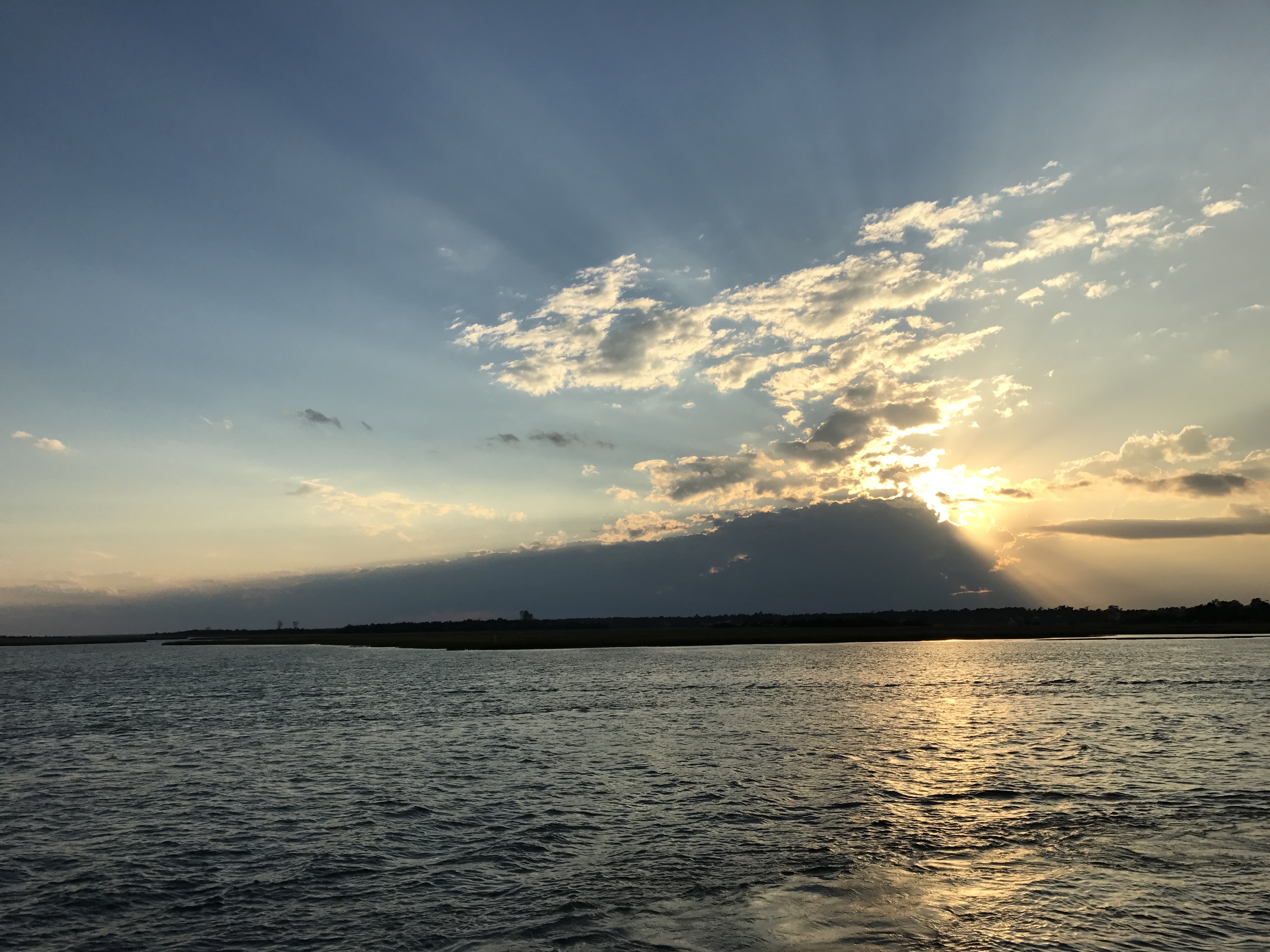
Yay for bonus sunsets
Nancy and Paula dropped me off at my Airbnb (summary: nice and quiet, no New Orleans-style murder) and I was in for the night, modulo a quick run to CVS for some Advil. I checked the weather forecast a few dozen times to get some idea of what the winds would be like. As I tried to drift off to sleep, I mulled over what reasonable goal times for the day would be. All I really wanted was to beat my NOLA 70.3 time, but I
Saturday pre-race: patheticness everywhere
Stan, Karen, Paula, and Nancy were kind enough to let me carpool with them, then stop so I could grab some breakfast, then to loan me $5 because I had pathetically forgotten my wallet. I had a gas station protein bar and a 20oz Coke… breakfast of champions, right? We got to T1 in plenty of time for me to fill my bike bottles with Mercury, pump up my tires, and check once more to make sure I had everything in my “morning clothes” bag that I wanted. See, at the swim start, you leave that bag there, and you don’t get it again until after the race. It’s a good place for things like eyeglasses and cell phones. T1 was crowded, as you’d expect for a race with nearly 3000 athletes. I was way in the far left back corner, which turned out to not be so bad because it was easy to find.

Transition 1 on race morning
Last-minute preparation accomplished, I caught a shuttle to the swim start and met up with my pathetic pals there. Stan had loaned me a cap, which I was glad to have because it was chilly; I put on my wetsuit earlier than I normally would have, and it helped quite a bit while we waited. I got to the swim start about 8:10, and my wave wasn’t due to start until 9:06, so I had some time to mill around. I found that I still had my chapstick with me, even though I should’ve left it in my run bag. Solution: put it in the top of my swim cap. It survived, luckily, and didn’t get too much extra ocean flavor. Almost before I knew it, they were herding our swim wave across the street and into the waist-high water behind the start line. The water was warmer than the air, and it felt great after I’d been standing outside being cold for an hour.
The swim
39:53, a new PR for me at this distance and roughly 20 minutes faster than my New Orleans performance. This course was linear so my poor sighting didn’t put me at much of a disadvantage, and there was a fast current to boot. I swallowed a good bit of salt water so I was worried about having to vomit– usually an automatic cause for the support staff to pull you– but I ended up OK. At swim exit I was wobbly from all the time spent swimming through chop; the second half of the swim was mostly into the surface chop so I was a little, if not seasick, then seasickish. When I exited the water, I noticed that my watch said “Resume?” and had recorded only about 1030 yards of the swim. I guess I accidentally hit a button with my wetsuit cuff or something. So much for an accurate swim distance.
T1
14:28? Jeez. The run from the swim exit to the bike corral was long, and I did stop in the changing tent to put on sunscreen, a dry shirt, and lots of chamois butter… but I had no idea I was in T1 for this long. I felt really stupid when I saw my race results, because this should’ve been no more than a 5-minute stop. Once I got all my stuff together, I got to the mount line and headed out on the bike.
The bike
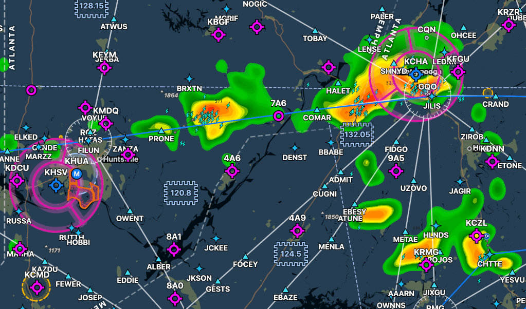
Before the race, there was a great uproar because of IRONMAN’s decision to shorten the full-distance bike course. During race week, they announced a couple of route changes (and more were rumored), but by race day they’d settled on one 56-mile route for both half and full-distance races. It was windy, with forecast winds of 13-15 mph from the west. We got all that and more– the wind history at ILM was 12.1mph for 24 hours, with a highest sustained wind of 22mph and peak gusts of 27mph. The bike course itself was a big part of the problem– its structure meant that we went out, did a loop, and then came back, starting from the green dot. The loop was south on 421, then north to the turnaround (where a gas station was selling fried chicken that smelled indecently delicious), then south again. Since the wind was coming from the west, we had very significant wind exposure– more miles than I think we got in the out-and-back New Orleans course.
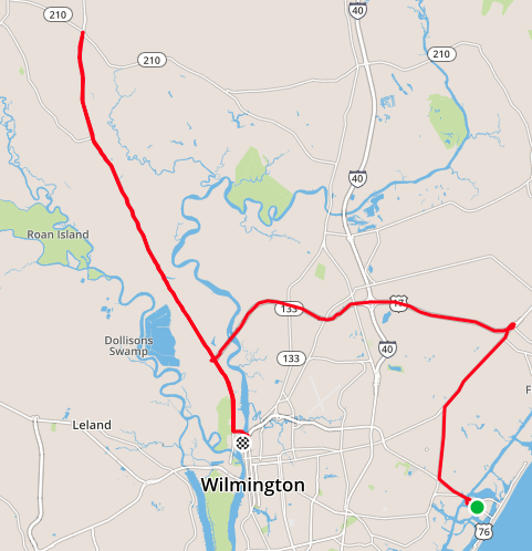
the bike course
If you look at my lap times you can absolutely see the last 8 miles of tailwinds… and the other 48 or so of cross/head winds. I averaged 14.5mph on the first 39 miles and 17.6mph on the way back. Despite that gap in speeds, I felt really good on the bike. I passed nearly 100 people, which was an absolute first for me– I usually start at a deficit when coming out the water that I can’t make up on the road. I held the power target that I wanted, I didn’t wreck in the strong crosswinds, and with the winds, I came in just over my target time of 3:30. (obtw, those Aeolus race wheels were excellent.)
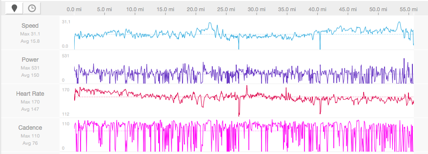
bike data… too many cadence spikes
There was a fair bit of (justified) complaining online because the aid stations weren’t were the athletes’ guide promised, and each one only had 2 porta-potties.
EDITED TO ADD: here’s a video of the bike route provided by relive.cc.
T2
Back through the changing tent and out again; this time it only took me 9:21… still ridiculously slow. That time comprised walking my bike down a long string of rubber mats overlaid on top of the gravel/dirt construction mix on the street where the bike finished, getting into the corral and getting my run bag, hitting the changing tent, and actually changing, then leaving again. I’m still not really sure where the timing mat was.
The run
2:28. That’s really all I have to say about that. Faster than NO, but still ~ 30min slower than my standalone 13.1 pace. Lots of room for improvement here. The run course was semi-scenic; the first leg went through downtown, where there was a moderate crowd, then along an ugly industrial section of Front Street, then over to Greenfield Lake, which is ringed with city-provided signs that say “YES, there are alligators in this lake. Do not feed, harass, or tease them.” It’s a delightfully scenic lake, though, and (unlike the bike) there were plentiful, well-stocked aid stations. The full-distance racers had to do two loops of the course, whereas I only had one, for which I was grateful. I tried Red Bull for the first time on the course; while it didn’t give me superpowers, it also didn’t make my stomach convulse, so I’ll score that as a draw. I saw Pathetic Nancy on the run (I spotted the “#P” marked on her calf as I passed her), and I met Robert Moore, one of the “PPD Heroes” featured by the race sponsor. Then I ran the last mile or so with a lady who was finishing the full-distance race and we chatted a bit– that was a pleasant way to get to the finish line. Oddly, there were fewer spectators out when I came back through downtown on the return, which surprised me a bit.

YES, there are alligators in this lake
Post-race
The finish line experience was great– I crossed, got my medal and pajama pants, and wandered around for a bit catching my breath. Unfortunately, soon I had to go pick up 3 bags of stuff: my run, bike, and morning clothes bags were all in different places. It took me close to 30 minutes of schlepping around to collect the bags and my bike, which was far longer than I wanted to spend. I grabbed an Uber back to the house, took a badly needed hot shower, and headed over to Hops Supply for dinner. I wasn’t up late.
The trip home
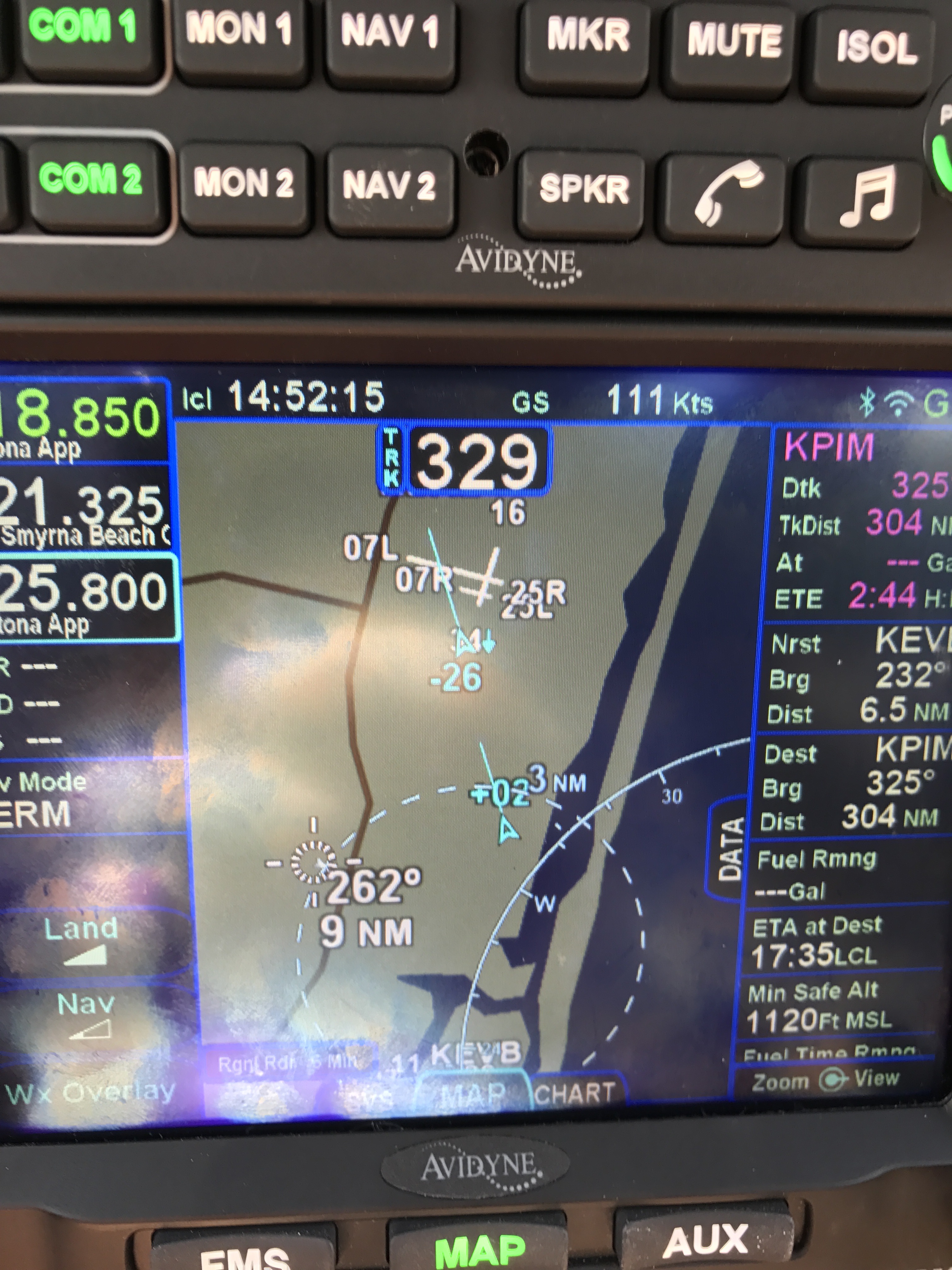
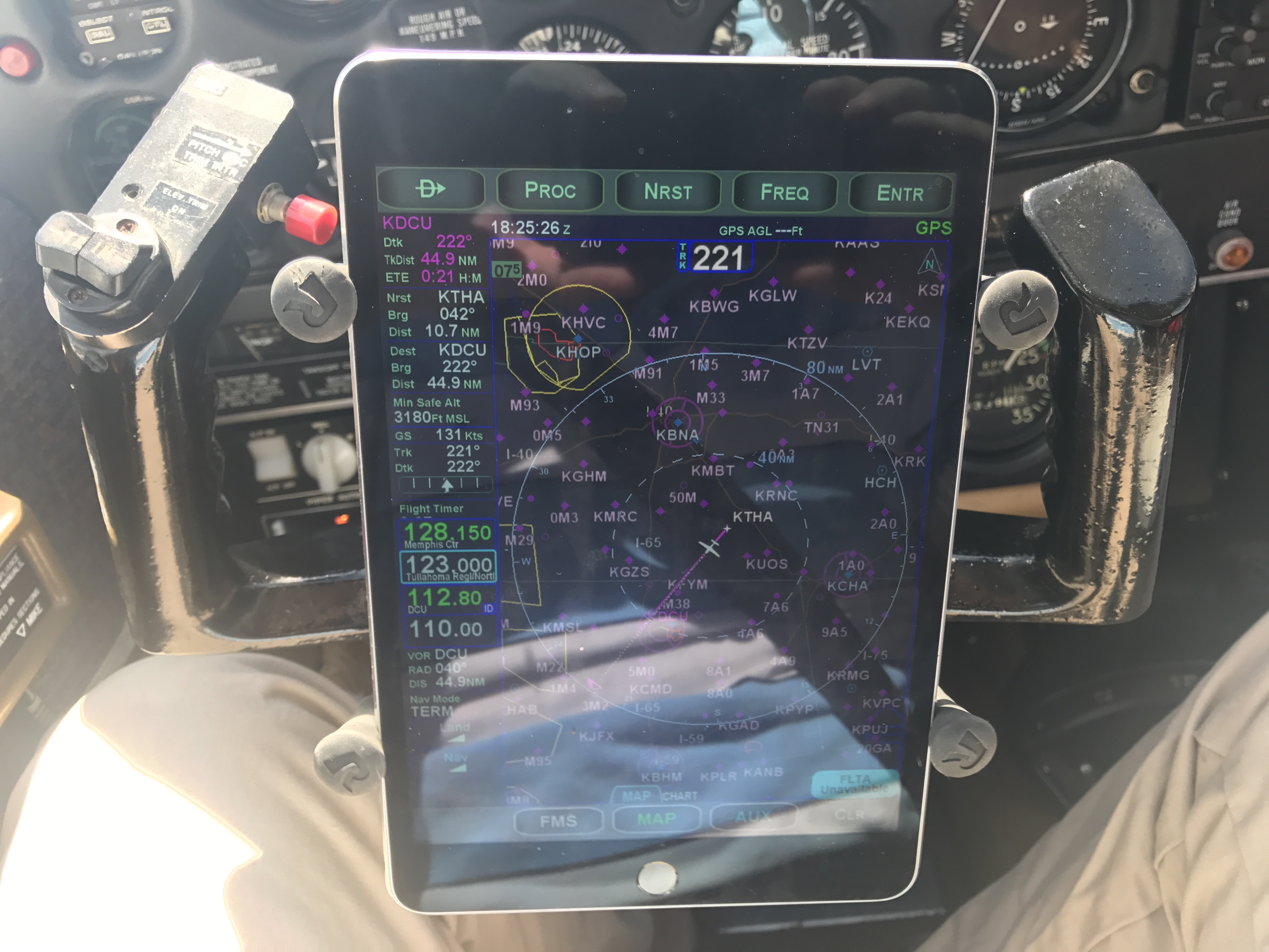
This morning, I woke up at 5 with a goal of being wheels-up by 6. Plot twist: there aren’t any Uber drivers awake that early, apparently. I eventually got a car and got to the airport to find that my plane was parked out on the back 40 and had to be towed to where I could access it. 45min after my desired time, I was airborne for Peachtree-DeKalb to meet my best friend from high school, the illustrious Brian Albro. We had a fantastic but short visit (thank you, Flying Biscuit, for breakfast), then I headed back. My flight was smooth and beautiful. I got to see some Harriers parked on the ramp at ILM, some great river fog, and a lot of greenery.


The fog follows the river path exactly
Summary
A great race and a worthy effort. There were a lot of logistical hiccups; for example, the 70.3 athlete tracking on the IM website never worked, and the bike course caused a ton of traffic problems for locals that mean this will be an unpopular race next year. I got 7.5 flying hours and 7.2 hours on the triathlon route, so it was a good trip.