
| Pro tip: remember the lava video from day 1? In the US you’d never be able to get so close to something so dangerous. In Iceland, though, their approach is much more grown-up. Hazards are clearly marked but, even on the steepest cliffs or most dangerous areas, there aren’t that many physical barriers to actively prevent you from doing stupid things. So don’t be stupid. (Included in “don’t be stupid”: traffic laws are vigorously enforced and, if you pay your fine on the spot in cash, you get a 25% discount.) Other things you should be aware of that may be forbidden include drones (not allowed in national parks and at most attractions), driving without headlights, pulling off the side of the road to take pictures, and driving on closed roads. |  |
The “Ring Road” is the English nickname for Icelandic highway 1, which goes more or less around the perimeter of the island. The perimeter of Iceland is about the same length as the perimeter of Kentucky, so you can see that driving it might take you a little while. Many visitors rent a camper van and navigate all the way around the ring, stopping whenever they want to see one of the many sights, but that requires you to spend a ton of time d…r…i…v…i…n….g at 40-50mph on narrow roads, possibly in high winds, rain, and/or snow, and that wasn’t how we wanted to spend our trip. Instead, we agreed that we’d take a day and drive from Reykjavik over to Vík and back. Several tour companies offer bus tours along this route, but we couldn’t book one for any of the days we wanted to go, again due to low tourist demand. In the event, this worked out well and I’m glad we did the tour ourselves.

Our planned route was to start in the city, stop at Seljalandfoss, then Skógafoss, then on to Vík. The map above shows the actual route we took– I mistakenly navigated us to Selfoss, which was a non-event since it was pretty much on the route anyway.
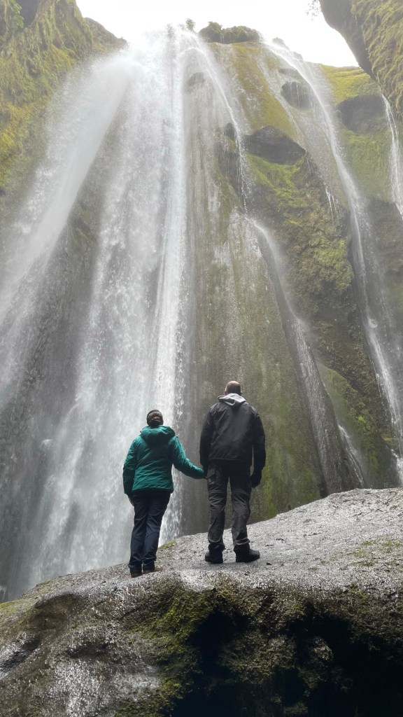
First stop was the waterfall at Seljalandfoss. It’s clearly visible from the road, so you can’t miss it. You have to pay a few hundred ISK to park (around US$3), and there’s a small coffee stand and bathrooms. The waterfall itself is a super easy hike. In the first picture below, you can see a few tiny people in the background; you can easily hike behind the waterfall, then up a small trail (maybe 200 yds) onto the other side.


We spent about an hour there, then it was time for the short drive to Skógafoss. Like Seljalandfoss, it’s easy to see from the main road, but it’s also well marked by signs. Along the route you can see some Icelandic turf houses if you’re interested. There’s also a building with a big painting of the Eyjafjallajökull volcanic eruption from 2010, and there used to be a museum and visitors’ center, but it’s now closed.
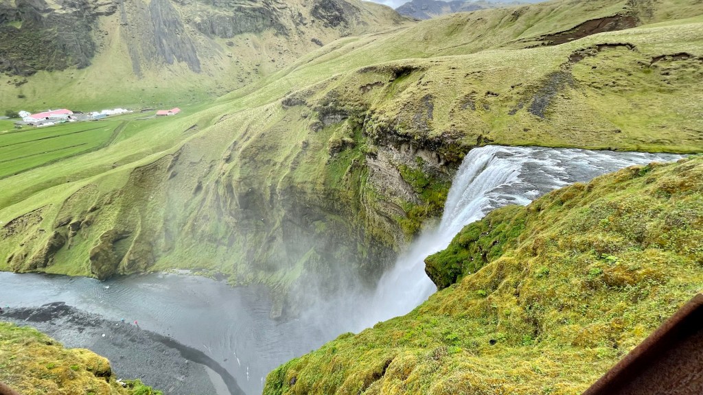
The Skógafoss waterfall is another easy hike (maybe 1/4mi) from the parking lot to the base of the falls. Unlike Seljalandfoss, there are plenty of sea birds around, both in flight and nesting in the cliffs.

A set of about 300 steps leads off to the right side of the waterfall and the headwaters that feed it. It’s not an especially taxing climb, it just takes a little while. The view from the top is absolutely worth it, though. The trail continues on for another half mile at least; for that distance you’re hiking alongside a rocky stream, but the view down across the valley and towards the coast is better so we just stayed there for a few minutes admiring it.
We were pretty famished so elected to have lunch at the nearest restaurant, the Hotel Skógafoss. There are one or two other restaurants there, along with some rental cabins and another hotel. Excellent choice. The food was inexpensive (about $45 for two entrees plus dessert) and delicious. I had Icelandic lamb soup (which is the Icelandic equivalent of Swedish meatballs– nearly every place has it) and Erica had a really good lamb burger.
We’d previously debated whether to walk out and see the crashed plane at Sólheimasandur. It crashed in 1973 and the US Navy basically just left the wreck in place– it’s not the kind of thing you can see every day, so we decided we felt perky enough to do it. The hike is super easy: 45min out on a level trail, mostly packed gravel with some bigger rocks embedded, will take you to the plane. Sure enough, when we got there we found… a crashed airplane. Exactly as advertised. (Note that the trail is marked but there aren’t any signs, bathrooms, or water available.) The weather couldn’t have been nicer, though– it was about 45 degrees, with a steady but not obnoxious wind, mostly-clear skies, and plenty of sunshine.

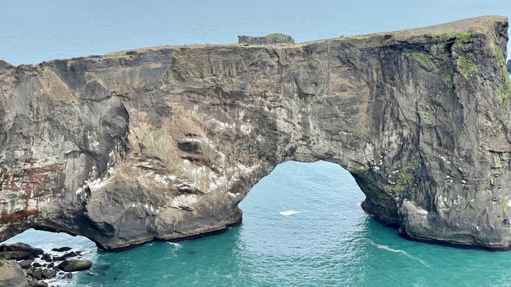
Our next planned stop was the Dyrhólaey nature reserve, which gets its name (literally “door hole” in Icelandic) from its famous arch. This was the closest thing to an American-style national park that we had seen so far; there’s a small visitors’ center with bathrooms, and there are park rangers. When we were there, they closed the preserve daily at 7pm to protect seabird nesting grounds, although this is seasonal. It’s no more than a couple hundred yards from the parking area to the main trail, so it was probably the easiest walk of the entire day.

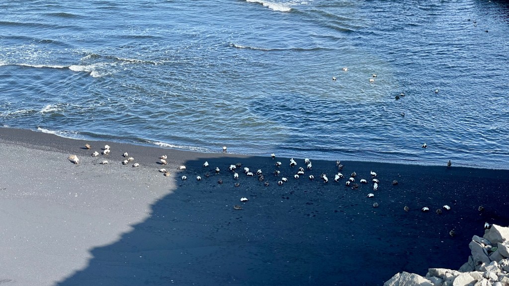

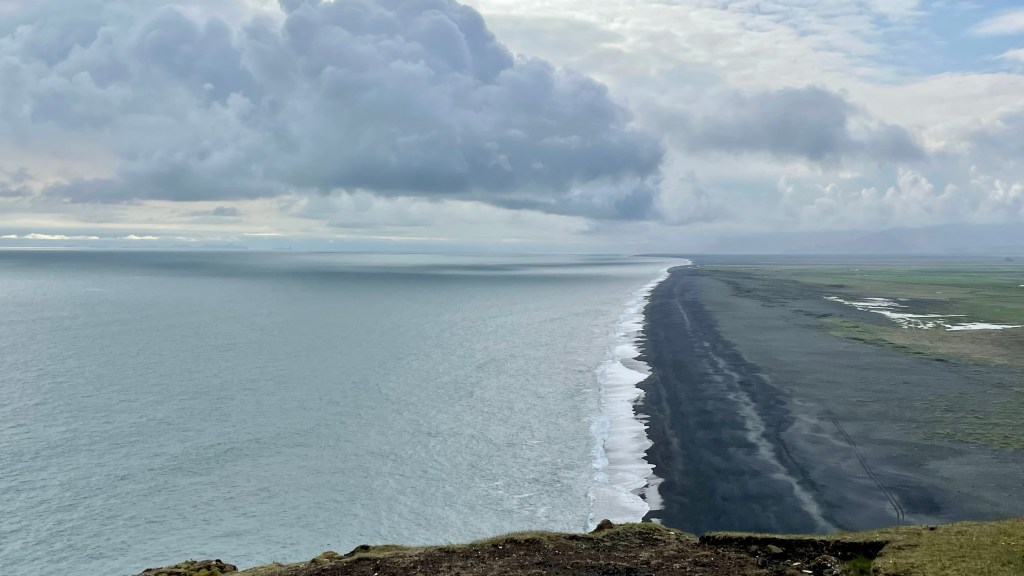
After Dyrhólaey, our next stop was the black-sand beaches at Reynisfjara. By the time we got there, the clouds had lowered quite a bit and the wind had picked up. As we walked towards the beach, we saw signs cautioning visitors about “sneaker waves” so we stayed well away from the surf line itself (more because we didn’t want to get cold and wet than because we feared the waves!) The black sand of the beaches is really arresting– the area closest to the water is actually sand but then above the waterline it turns to shale pebbles, not unlike the beaches near Nice. Apart from the color, it’s… sand. It crunches like sand, absorbs water like sand, and shows footprints like sand. One major difference that I noticed between Gulf beaches and this area: we didn’t see any sea life– no crabs, bugs, etc., and no birds hunting for critters along the waterline.

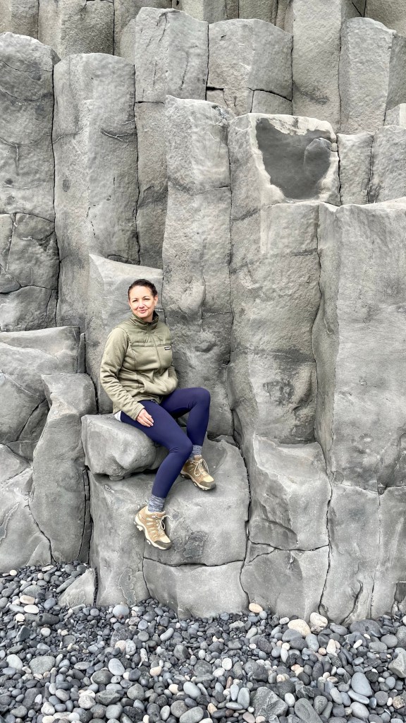
There’s a small cave and a really interesting formation of basalt columns. They look so regular and rectangular that they give the appearance of being man-made… but they’re not. They’re just the right height and shape for a quick photo perch, though.

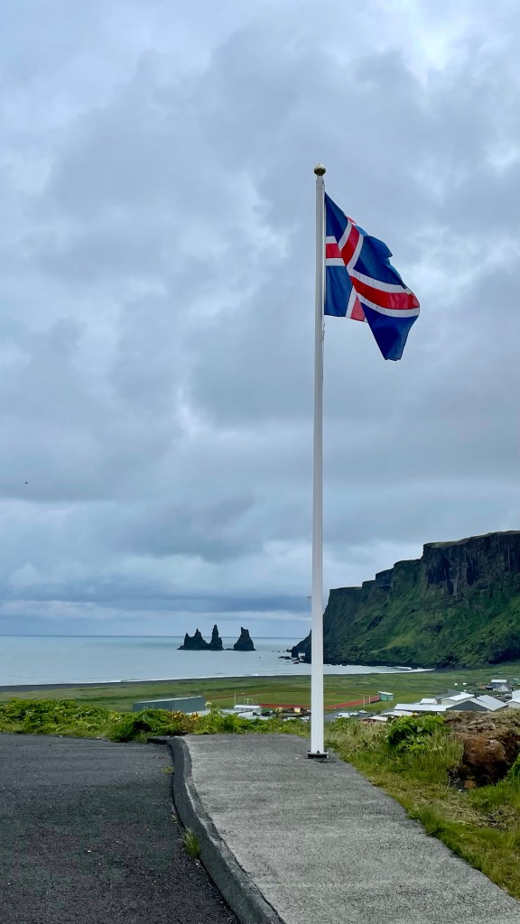
By the time we were done on the beach, it was around 7pm and, once again, we were ready to eat. We drove the short distance to Vik to explore a bit and find dinner. The highlight was seeing this church, which was designed by the same architect as Hallsgrimkirkja. You can’t tell from looking at it, since this looks pretty much like every other local church we saw the entire time, and it sure doesn’t look like Hallsgrimkirkja.

For dinner, we ended up at Halldorskaffi, mostly because it was open; after a short wait, they seated us and we both ordered the lamb sandwich. They were good but not exceptional; for dessert, we shared a slice of meringue cake but the star of the meal was the accompanying locally-made ice cream. We left the restaurant about 830p and were back in the city right at 11pm to rest up for our next set of adventures.


Pingback: Iceland 2021, day 3: snorkeling Silfra and driving the Golden Circle | Paul's Down-Home Page
Pingback: Iceland 2021 day 4: up north to Langjökull | Paul's Down-Home Page
Pingback: Iceland 2021 day 5, horses and the Blue Lagoon | Paul's Down-Home Page