
(see previous parts: part 0, part 1, part 2, part 3)
The big attraction of this day’s hike was the ability to climb up the ridge on Mount Nanos, which is actually a big limestone plateau and not a proper mountain. On one side it’s a huge mostly sheer set of cliffs, sort of like parts of Yellowstone, but those don’t photograph all that well with a cellphone camera. Here’s a small sample– note the exposed rock up at the top.
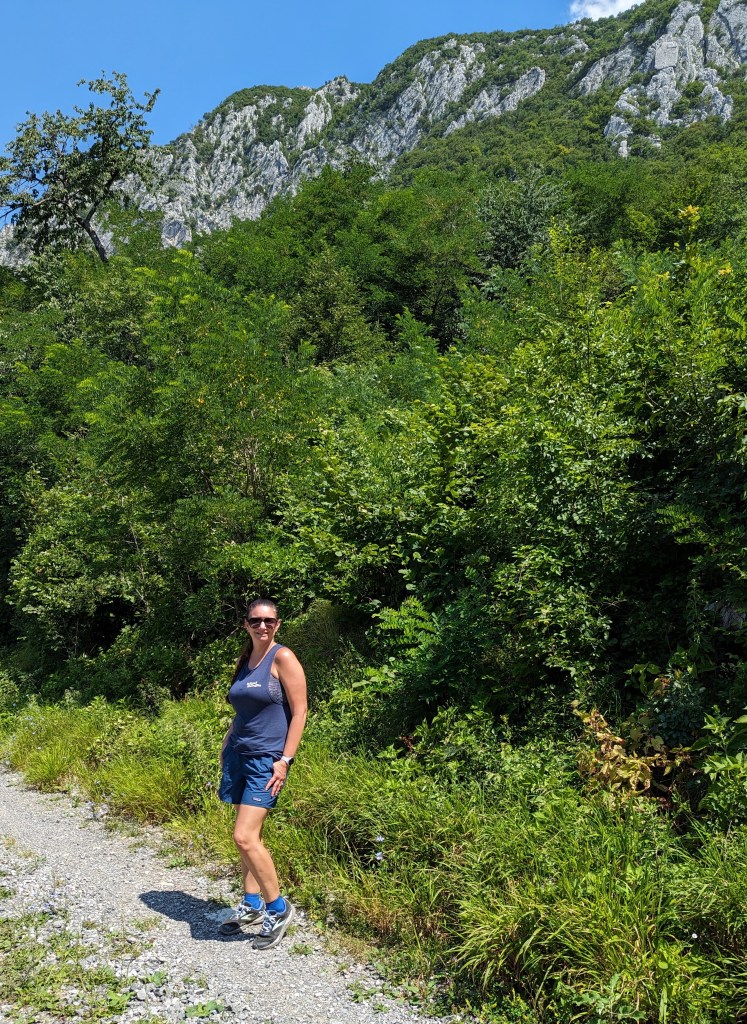
The hike started at a small church but, after a short walk to the trailhead, we were quickly headed uphill. We saw lots of people hiking down the trail, which explained the full parking lot at the trailhead. This made sense once we realized that it was still early and most of the hikers we saw had clearly gone out for a quick hike before it got too hot.
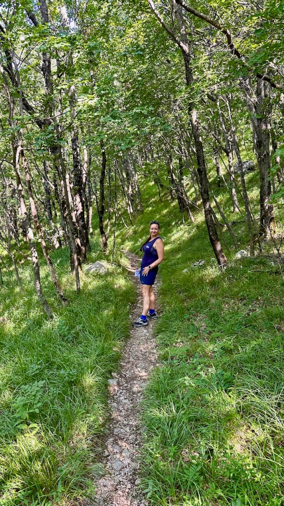
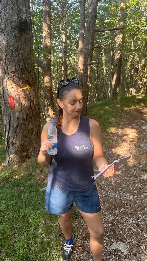
The route instructions called for us to climb up to one of the designated waypoints, then decide if we wanted the main route or the one that went up on the ridge for better views. The trail was marked both with yellow arrows and small red-and-white marks that look like the Target logo, which were super helpful, and the turn-by-turn directions were also very detailed.
I was using the GPS map on my phone for route guidance, and Erica was cross-checking with the printed directions. This system worked pretty well for us, except in this one specific case. See, the directions basically said “for the main route, do X, Y, Z” for, oh, maybe 8 pages. At the end of that section, it then said “and if you want to climb the ridge, instead of Y, do P, D, and Q.” So we missed the turn onto the ridge route at first, and didn’t realize it until we were well along the main route.
We didn’t notice because of two reasons. First was that we were hearing voices… really. Somewhere in the valley below is a motorsports track, and we could hear roaring engines and the track announcer. There was too much foliage alongside the trail for us to directly see the track but we could definitely hear it. The other is that the trail we were on was marked; I just didn’t notice the aforementioned split in the before/after directions until we were quite some distance in.
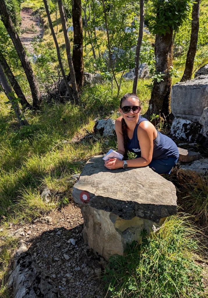
Luckily, the AllTrails map showed all of the trails in the area, not just the ones we were on. We found a side trail that angled off about 45º to our track and that joined the marked route for the ridge. This trail didn’t have as many of the trail markers as I would have liked, so we made a couple of wrong turns. Sadly, each of those wrong turns involved a steep climb, followed by puzzlement, swearing, and backtracking. Eventually we found the correct path, which linked up with the ridge route, and we got some of the promised amazing views.
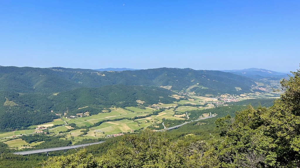

The path eventually ran alongside a small road, with lots of switchbacks; in one of those switchbacks we found a shaded bench to sit on for lunch. There I had one of the best lunches I can remember: there was a small water trough with fresh, and extremely cold, water, an amazing view shared with my lovely wife, and a delicious lunch consisting of farm-fresh fruit and sandwiches, on homemade bread, of local cheese, uncured ham, and… wait for it… donkey salami.
Yes, you read that right.
It was very tasty. Sorry, Eeyore.
Anyway, after an amazing lunch, it was back onto the trail. We moved into a more forested area, with the highlight being a stop at the Church of St. Niklaus, which dates back at least to 1608. We couldn’t go in, but I did manage to ring the church bells. At first I tried using a tree branch, but after a little research, I found the bamboo rod, with a convenient hook on the end, that was meant for bell-ringing, so I gave it a try. (annoyingly, I can’t make WordPress uncrop the video, the dirty rats. Watch it full-screen if you actually want to see the bells.)
That probably isn’t allowed, so we fled the area fairly quickly, only to find out that we were in an old artillery range that used to be used by the Yugoslavian army back in the day. We didn’t think it was in time of shooting, so we pressed on.

This part of the trail was neat because to our right we had the sheer faces of Nanos, and between that and the trail were large fields of scree and gravel. Clearly rock had fallen down off the face and been weathered into smaller and smaller pieces before it ended up underfoot. You could see spots on the face where a large rock had broken off and fallen, then the fallen rock itself… sort of like those maps of Pangaea that show the primordial continent evolving into today’s arrangement. The path was mostly trending downhill, and soon enough we came out of the forest and found a lovely oasis in the form of Kamp Tura. This is, essentially, a Slovene KOA, with spots for tents or campers, a shower house and bathrooms, sports courts, and a nice little cafe where I drank two brain-freezingly cold Coke Zeros while we chatted with Bojena, one of the owners.
Pro tip: on the entire trip we found approximately zero public restrooms. That turned out not to be a problem because it was so hot that we didn’t need any pee breaks en route, but you should plan accordingly if you do this route in less-sweaty conditions.
After Kamp Tura, it was an easy downhill leg through some vineyards and past what looked like a Soviet-era industrial complex (but which turned out to be a winery!) before we got into Vipava itself. Vipava’s a real town, with a few restaurants and bars on the town square. On Foot had booked us into a very nice little tourist apartment; after checking in, cranking up the AC, and doing a little sink laundry, we headed out to try to find a wine tasting. The only problem is, the nearest winery was a couple of miles away uphill– and there are no taxis in or around Vipava. So that was right out. Luckily, the family that operates the apartments also runs a small winery, Wipach, and there’s a small wine shop on the ground floor. We had an amazing tasting hosted by one of the winery owners, a charming schoolteacher who runs the winery with her husband. She’s the grand-daughter of one of the winery’s two founders and her husband is the grandson of the other founder… so it’s absolutely a family concern.
After the tasting, we got cleaned up for dinner. Our apartment hostess had asked if we liked pizza; when we said “yes,” that’s what we were expecting. Instead…

…she booked us a table at Gostilna Podfarovz, where we had an amazing dinner consisting of, well, I’m not really sure. The photo above is our soup: cucumber and zucchini cold soup with kefir on top, and some kind of little puffy thing with raspberry balls on it. There was a course of trout tartare and beef tartare; there was lamb; there were various other odd combinations of ingredients that I would never have ordered but which I was happy to eat. In fact, they fed us so much that we had to decline dessert. All throughout dinner we saw people walking by with ice cream, and we kept joking about how good ice cream would be before bed… except we just didn’t have room.
Full of lamb-trout-mystery-food, we went back to the apartment to make an early-ish night of it; the next day’s segment was going to be hilly and hot without a lot of shade so we wanted an early start.


What was rhe second reason why you didn’t notice that you missed the path? I think some words went missing after “The bigger and more interesting reason is that”.
Nice catch, Scott– you can tell I wrote this post over several sittings. It’s fixed now.
Pingback: 2023 Italy / Slovenia: Vipava to Kodreti | Paul's Down-Home Page